Documentation
How the SEBELO system works, how a site is planned and how the sensors are installed: what you need to know before the first sensor goes up.
2
signals: a chemical fingerprint of the air, confirmed by an optical particle measurement
0
batteries: a small solar panel charges capacitors
10
years of design life outdoors, in a sealed IP67 enclosure
6
countries with live field demonstrations
The sensor is still in development: specifications may change, and the photos show pre-series units.
How the system works
SEBELO is a network of small solar-powered sensors mounted on trees. Each one samples the air, recognises smoke with an AI model on the device and reports over LoRaWAN to the SEBELO platform, which alerts the people responsible.
Sensors
One per hectare as a baseline. Each unit recognises smoke on the device and also measures particles, temperature, humidity and air pressure.
LoRaWAN network
Low-power, long-range radio in the licence-free band of your region. Any standard gateway in range carries the messages.
Platform
Every sensor on a map with live wind. The platform keeps the history and rates each reading as normal, warning or critical.
Alerts
Warnings and critical alerts go out by SMS and e-mail, with the position of the sensor that raised them.
How a sensor detects smoke
Detection relies on two independent signals: the chemical fingerprint of the air and an optical measurement of airborne particles.
1. Scan
In short cycles, the gas sensor reads the air and records its chemical fingerprint.
2. Recognise
An AI model on the sensor rates each reading from 0 to 100%: how likely it is that the air contains smoke.
3. Confirm
An optical measurement of airborne particles confirms the chemical detection.
4. Report
In clean air, the sensor sends a status report every hour. From 10% it reports continuously.
Alert levels
| Level | Smoke classification | What happens |
|---|---|---|
| Normal | below 10% | Routine status reports every hour. |
| Warning | 10 to 29% | The sensor reports continuously and a warning goes out by SMS and e-mail. |
| Critical | 30% and above | The highest alert level, sent by SMS and e-mail with the sensor's position. |
Every report also carries the particle levels, temperature, humidity, air pressure and the sensor's own storage voltage, so you can see the conditions behind each alert.
Planning a deployment
Coverage starts from a baseline grid and is tightened where fires are most likely to begin. Before installation, SEBELO analyses the whole territory and recommends where each sensor should go.
Placement rules
Forest interior
A 100 m grid: one sensor per hectare.
Roads and trails
One extra sensor every 100 m beside the line, on alternating sides.
Rest areas and campsites
A ring of sensors around the area.
Buildings
Sensors on the forest edge facing the buildings.
Example: 100 hectares of forest
- Baseline grid
- 98
- Road, 1 km
- +9
- Trail, 480 m
- +4
- Rest area
- +6
- Building
- +4
- Total
- 121 sensors
- Gateways
- 1
About 1.2 sensors per hectare. The placement in the example is illustrative.
96%
of wildfires in the EU are caused by human activity, so coverage is densest where people are.
European Commission, Joint Research Centre: Forest Fires in Europe, Middle East and North Africa 2022How SEBELO plans a site
- 1
Map the territory
Boundaries, forest stands, roads and trails, buildings, power lines, terrain and the prevailing wind.
- 2
Rank the risk
Where is a fire most likely to start, and what would it threaten first?
- 3
Place the sensors
A baseline grid, denser zones and gateway positions with radio coverage.
- 4
Deliver the plan
A map and a coordinate list for every sensor, ready for the installation team.
Network and gateway
The sensors use LoRaWAN, an open standard for low-power, long-range radio, in the licence-free band of your region. No proprietary base station is needed.
With your own network
If you already run LoRaWAN, the sensors can join it. Any standard gateway in range receives their messages.
With a new gateway
No network yet? One gateway with power and an internet connection can serve a whole site. Its position is planned together with the sensor positions.
What a gateway needs
- A high mounting point: a mast, tower or roof, above the tree canopy if possible
- Power: mains, PoE or a solar kit
- Internet: Ethernet or mobile data
- An outdoor LoRaWAN gateway for your region's band
Radio facts
- Regional versions
- EU868, US915, AU915, AS923 and others
- Range
- Up to 10 km with line of sight; shorter under a closed canopy, so coverage is checked on site
- Routine traffic
- One status message per sensor every hour
- During an alert
- Continuous reports from the sensors that detect smoke
A hundred sensors in routine mode send about 2,400 short messages a day: a light load for a single gateway.
Installing the sensors
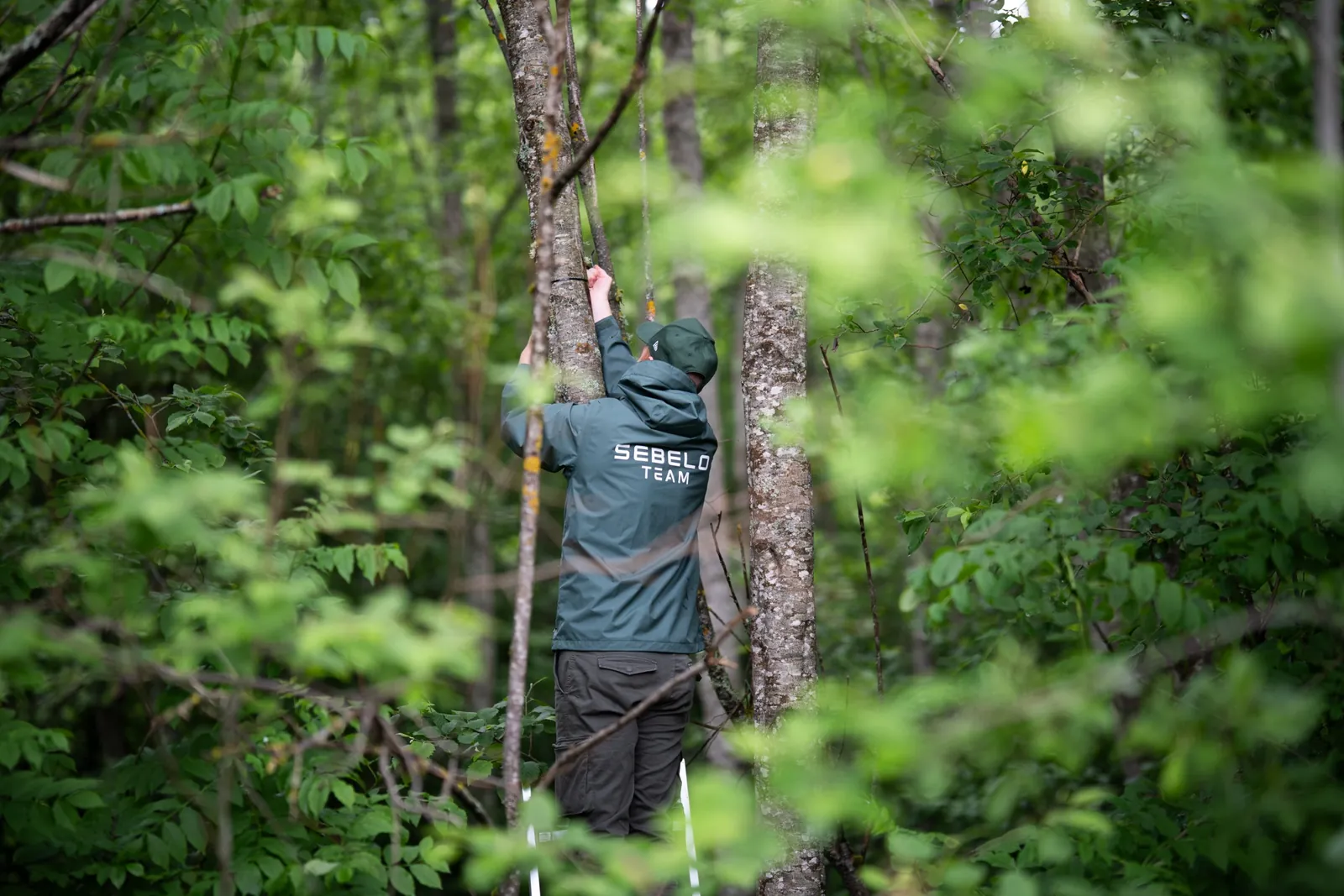
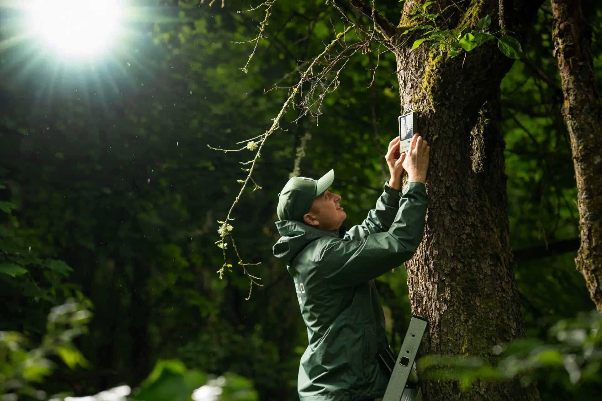
No wiring, no switch, no battery to change and no planned maintenance. Each sensor is added to the platform under the ID on its label, hung on a trunk and left to work.
Before installation day
- The placement plan with every sensor position
- A LoRaWAN gateway in range, with power and internet
- Platform access for the installation team
On site
- A ladder for a working height of about 3 m
- A drill, wooden dowels and screws
- A phone with the platform open
Step by step
- 1
Register
Add the sensor to the platform under the ID (DevEUI) printed on its label as text and QR code. Set its position from the placement plan.
- 2
Choose the side of the tree
Use a sound, living trunk at the planned position. Face the solar panel towards the most open sky, south where possible (north in the southern hemisphere), and keep the front clear of branches.
- 3
Mount at 3 metres
Hang the sensor upright by its hanging eye. Recommended: drill a hole, set a wooden dowel in it and drive in a screw. A nail, a plain screw, cable ties or temporary tape also work.
- 4
Check the alert path
Confirm on the platform that readings arrive. The built-in test alarm checks the whole chain, from the sensor to the SMS and e-mail alerts.
- 5
Let it calibrate
A new sensor adapts to the local air for up to 20 days, usually less. Install ahead of the fire season.
- 1Solar panel towards the open sky
- 2Screw in a wooden dowel
- ↕3 m
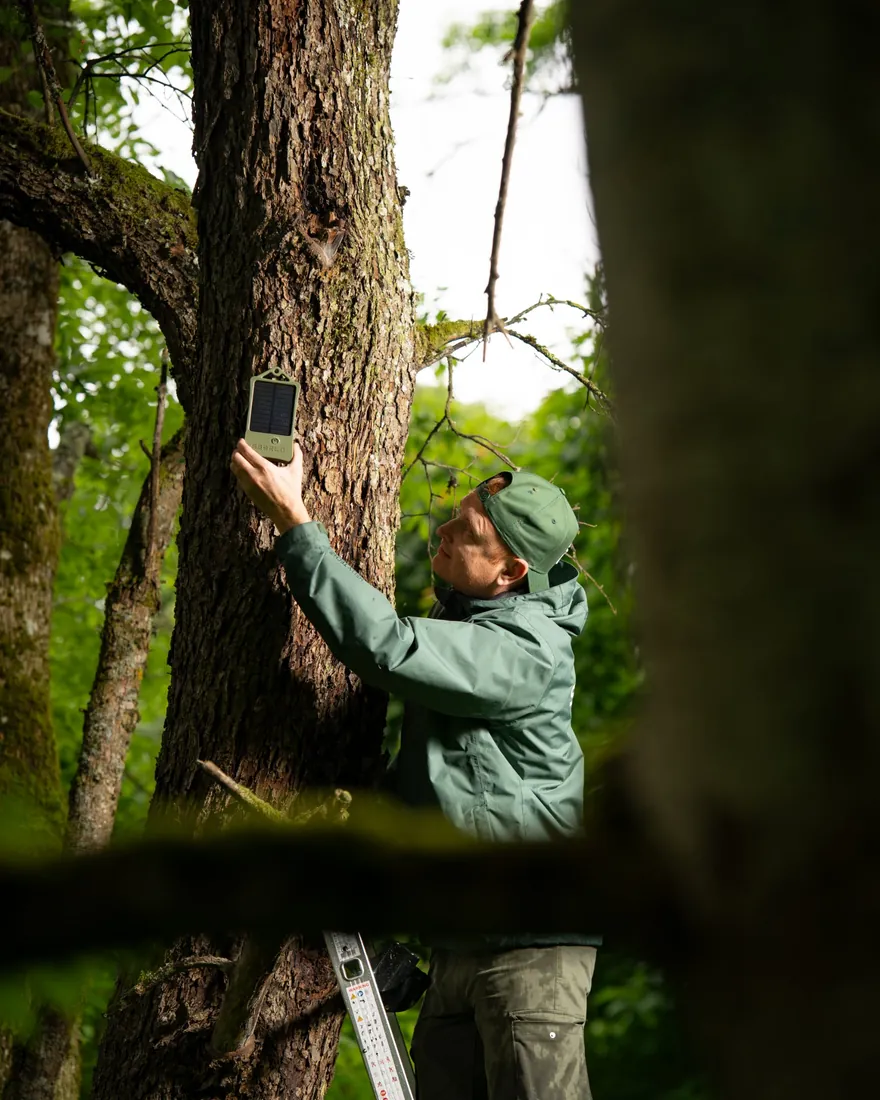
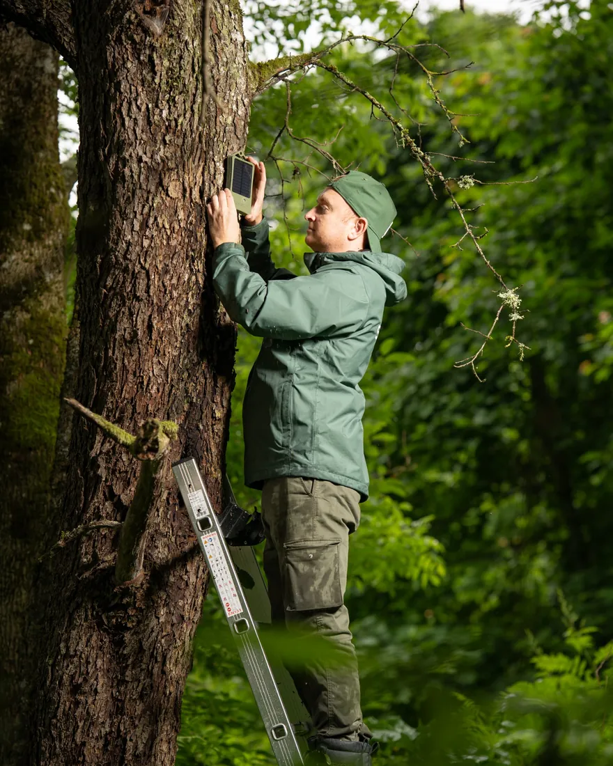
Pre-series units: the colour and shape of the final sensor differ.
The platform
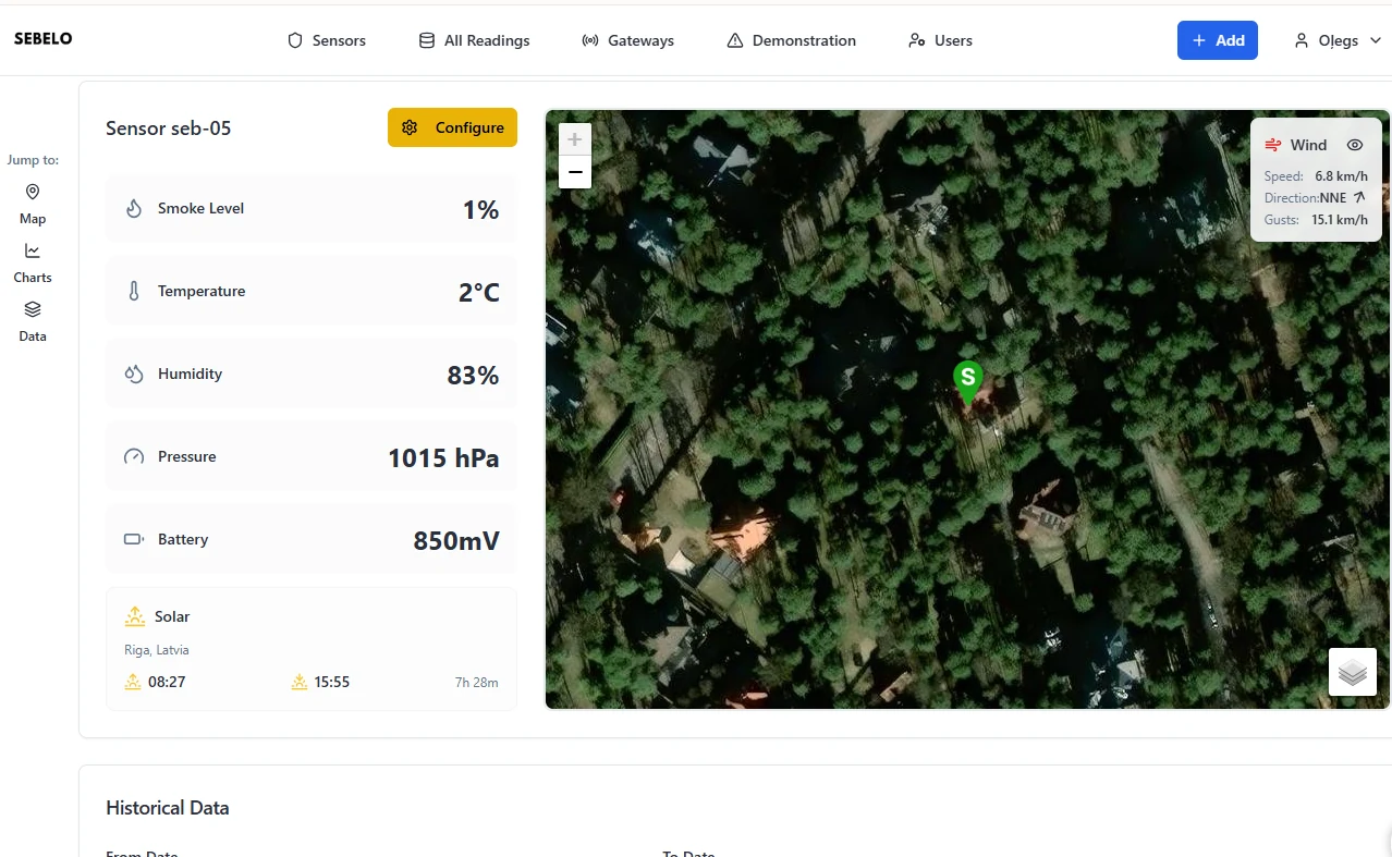
The platform runs in the browser at platform.sebelo.net, on a phone, tablet or computer. It shows where each sensor is, what it measures and which ones need attention.
Sensor view
Live readings for each sensor, its position on a satellite map and the live wind.
History
Charts for every measured value over any period. Every report is stored and can be exported as CSV.
Alerts
A smoke alert appears on the platform and goes out by SMS and e-mail, naming the sensor.
Sensor list
Every sensor with its smoke level and state: normal, warning or critical.
API
Connect the sensors to your own platform or control room through the SEBELO API.
Self-diagnostics
The storage voltage of every unit and the state of its optical path.
Demonstration sessions
Start a session, run a test fire and export a report with the timeline.
The value labelled “Battery” on the platform is the voltage of the sensor's capacitors.
Open the platformCare and maintenance
- There is no battery to replace: the solar panel charges the capacitors, and in routine mode a sensor keeps working for about two days without light.
- Check the self-diagnostics on the platform from time to time: storage voltage and the state of the optical path for every unit.
- As the vegetation grows, keep the solar panel and the front of the sensor clear of new branches and leaves.
- If you move a sensor, update its position on the platform.
- The enclosure is sealed to IP67 and has no moving parts; it is designed for 10 years outdoors.
Frequently asked questions
How many sensors do I need?
As a baseline, one sensor per hectare, with more along roads, trails, rest areas and buildings. In the 100-hectare example above that adds up to 121 sensors. SEBELO analyses your territory and proposes an exact placement plan.
Do I need my own LoRaWAN network?
No. If you already have one, the sensors join it. If not, one standard outdoor gateway with power and internet can usually serve a whole site; its position is planned together with the sensors.
How high should a sensor be mounted?
About 3 metres above the ground, on a sound living trunk, with the solar panel facing the most open sky.
When does a new sensor start working?
It reports as soon as it is registered and mounted, but it adapts to the local air for up to 20 days. Install sensors ahead of the fire season.
Who receives the alerts?
The people you set up on the platform. Warnings and critical alerts go out by SMS and e-mail with the sensor's position, and the API can pass them on to your own control room.
Do the sensors need maintenance?
There is no planned maintenance and no battery to change. The platform shows each sensor's storage voltage and optical path, so you can see if one needs attention.
Tell us about your territory
Send us its boundaries and what you need to protect. We will reply with a proposed placement plan and a quote.