Guide
Wildfires in Greece: what recent seasons teach about early detection
8 min read

Wildfires in Greece follow a clear pattern: firefighters stop the vast majority of fires while they are still tiny, but a small number of fires that escape the first attack burn most of the land every year. In 2025, 18 large fires caused 87% of the mapped burned area; in 2026, 12 fires did about 80% of it. The lesson from recent seasons is that the decisive minutes are the first ones, especially on windy days, at night and in remote areas, which is where earlier detection makes the biggest difference. Our forest wildfire detection system is built for exactly that window.
Wildfires in Greece by the numbers: 2023 to 2026
Greece's official fire season runs from 1 May to 31 October. The last four seasons show how different a year can be, and how much depends on a handful of fires.
| Season | Mapped burned area | What stood out | Source |
|---|---|---|---|
| 2023 | About 96,000 ha in the Evros fire alone | Largest wildfire ever recorded in the EU, near Alexandroupolis | Copernicus Climate Change Service |
| 2025 | About 47,800 ha (EFFIS); over 50,000 ha with small fires | 5th worst season since 2006; 75 mapped fires, 39% above average | WWF Greece & NOA FLAME review |
| 2026 | About 35,400 ha (EFFIS); over 40,000 ha with small fires | Below the 20-year average, but 11 deaths | WWF Greece & NOA FLAME review |
The 2023 Evros fire in north-eastern Greece burned about 96,000 hectares and is, according to the Copernicus European State of the Climate report, the largest wildfire ever recorded in the European Union. It remains the reference point for how far a single fire can run once it escapes.
In 2025, the fire season review by WWF Greece and the FLAME team of the National Observatory of Athens counted 75 fires mapped by the European Forest Fire Information System (EFFIS), covering about 47,800 hectares. The worst-hit places included Chios, where two fires in June and August burned about 11,450 hectares, 13.6% of the island, as well as Zakynthos, Keratea in East Attica and Feneos in Corinthia. Epirus had its worst season on record.
2026 burned less land but cost more lives. The same review team's latest report, summarised by Greek City Times, puts the EFFIS-mapped area at about 35,400 hectares and the death toll at 11. The largest fire, in West Attica around Porto Germeno, burned 11,339 hectares; fires near Rethymno in Crete burned 5,012 hectares, including two Natura 2000 sites.
Lesson 1: most fires are stopped, a few cause most of the damage
Greece is good at catching ordinary fires. Between 2010 and 2024, 95–97% of fires burned between 0.1 and 5 hectares, a sign of effective detection and initial attack. Yet about 4% of fires, those above 1,000 hectares, produced roughly 75% of all burned area, according to the 2025 WWF review.
Effective handling of most fires is not enough when a small number of incidents still causes most of the losses.
WWF Greece and NOA FLAME, review of the 2026 fire season
Large fires are usually the ones that start on days of strong wind and extreme fire danger, in places that are hard to see or reach, or at the same time as several other fires, when crews and aircraft are already committed. The 2025 review notes that on 12 August the response system held but was working at its limits, and that islands struggled to get reinforcements, leading to exhausted crews and flare-ups. On such days, every minute between ignition and the first alert decides whether a fire stays at a few square metres or becomes a landscape fire.
Lesson 2: almost every fire is started by people, and the grid matters
In 2025 Greece recorded 9,143 ignitions during the season. Of the fires that were investigated between 2000 and 2023, 91% were human-caused; in 2025, 376 people were arrested for arson, 87% of them for negligence. Officials reportedly linked about six in ten large fires of 2025, responsible for 55% of the burned area, to the electricity network, and the 2026 review again points to transmission and distribution lines behind some of the most destructive fires.
Fires along roads, settlement edges, farmland and power lines tend to start in predictable places. That makes them good candidates for fixed monitoring. We explain the main ignition sources in how do wildfires start, and the specific risks of fires caused by power lines.
Lesson 3: land that burns again recovers worse
Repeat fires are a growing problem. In 2026 about 5,944 hectares burned that had already burned within the past 20 years, mainly around Rethymno, Karystos, Porto Germeno, Skyros and Paros. Attica alone has lost at least 110,000 hectares to fire over two decades, and a fifth of that land has burned twice or more. A lightning fire near Konitsa in Epirus burned for about a month in a mature Bosnian pine forest, where recovery is now in doubt because few old trees survived.
Young forest regrowing after a fire is especially vulnerable: if it burns again before the trees can produce seed, it may not come back as forest at all. These areas deserve the closest watch.
How Greece detects wildfires today
Greek detection is layered. Each day of the season, the General Secretariat for Civil Protection issues a daily fire risk forecast map with five levels, from green (low) to red (state of alert), and agencies raise their readiness accordingly. On the ground, the Hellenic Fire Service, forest services, municipal teams, volunteers and fire lookout posts watch for smoke, and the public reports fires to the emergency services.
- Drones: the civil protection ministry expanded its fleet from about 40 drones in 2024 and 80 in 2025 to more than 100 drones in 2026, operating in all 13 regions with thermal and optical cameras and AI-assisted detection.
- Satellites: EFFIS and Copernicus map fire perimeters and burned areas; the 2025 review praised satellite mapping of fire perimeters.
- Lookouts and patrols: people in watchtowers and on patrol still spot many fires first, especially in daylight.
- Public calls: residents and passers-by report fires they see, which works best near roads and settlements.

Where early detection still has gaps
Each layer has blind spots. Cameras and lookouts need a line of sight, and smoke in a valley or under the canopy can stay hidden. Satellites pass at set times and are better at measuring a fire than at spotting a small one. Drones cover a lot of ground but have to be in the right place at the right moment. Public calls depend on someone being nearby, which is rarely the case at night or deep in the forest. Our comparison of early wildfire detection methods looks at these trade-offs in detail.
The Greek data points to a few places where a faster first alert would pay off most:
- Wildland-urban edges around Athens and other cities, where fires threaten homes within minutes.
- Islands, where reinforcements take longer to arrive.
- Power line corridors in forest and scrub.
- Recently burned and regrowing forest, which may not survive a second fire.
- Protected areas and remote mountain forest, such as Natura 2000 sites in Crete or old pine stands in Epirus.
How ground sensors complement Greece's detection system
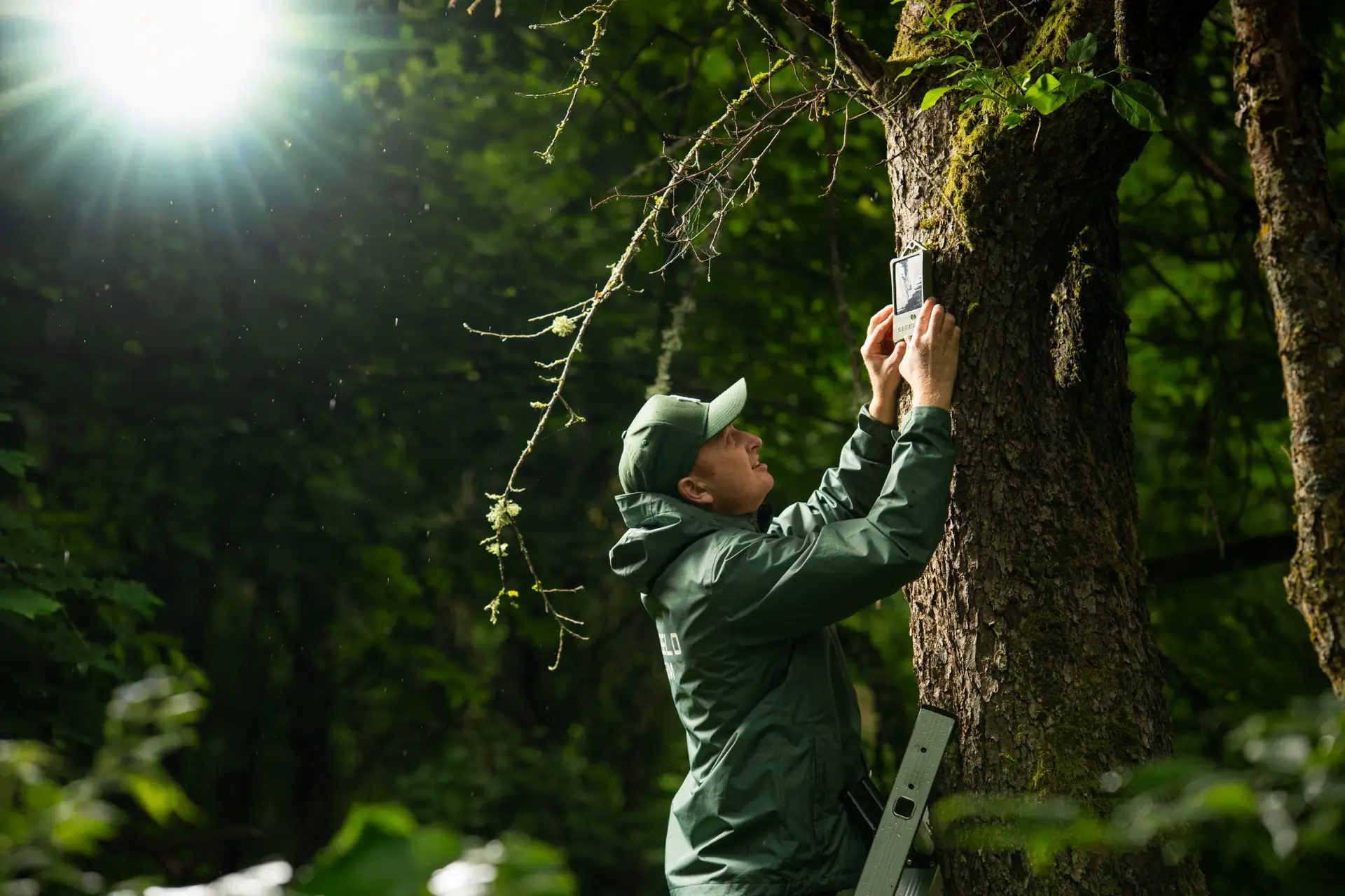
Ground sensors work at the other end of the scale from satellites: they sit inside the forest and react to smoke and fire gases in the air around them, day and night, without needing a line of sight. SEBELO's solar-powered wildfire sensors are mounted on trees, keep working for about two days without sun, and send alerts through a LoRaWAN network to the cloud platform, where they appear on a live map and go out by app, e-mail or SMS. An API can pass alerts to an existing operations centre.
Sensors do not replace drones, lookouts or fire crews. They add precise, early alerts in the places listed above, so that crews can go to a known location while the fire is still small. SEBELO is a Riga-based company; the sensor is still in development, with sales planned from early 2027. We have shown the system with live fires in front of fire services in France, Spain, Portugal and Romania, for example at the live demonstration in Valencia and the field test in Portugal.
What municipalities and forest owners in Greece can do now
- Follow the daily fire risk map and plan work with machinery, burning and patrols around it.
- Clear fuel around buildings and along roads, especially at settlement edges.
- Map your high-risk spots: power lines, landfill sites, roads through forest, and areas burned in the last 20 years.
- Check how a fire would be detected at night in each of those spots, and who would be alerted first.
- Add fixed monitoring where the gaps are, so that alerts do not depend on someone happening to see the smoke.
Greece has shown that fast initial attack works. The remaining challenge is making sure every fire is detected early enough for that attack to happen, including the few that would otherwise become the next large fire.
Frequently asked questions
When is wildfire season in Greece?
Greece's official fire season runs from 1 May to 31 October. During that period, the General Secretariat for Civil Protection publishes a daily fire risk forecast map with five levels, from green (low risk) to red (state of alert). The most destructive fires usually happen in July and August, during heatwaves and strong winds.
What was the largest wildfire in Greece?
The 2023 fire in Evros, near Alexandroupolis in north-eastern Greece, burned about 96,000 hectares. The Copernicus Climate Change Service describes it as the largest wildfire ever recorded in the European Union. In 2026, the largest fire was in West Attica around Porto Germeno, at 11,339 hectares.
What causes most wildfires in Greece?
People. Of the fires investigated between 2000 and 2023, 91% were human-caused, mostly through negligence such as burning, machinery or discarded cigarettes. The electricity network has also been linked to several of the largest recent fires. Lightning causes a small share, such as the 2026 fire near Konitsa in Epirus.
How are wildfires detected in Greece?
Greece combines several layers: fire lookout posts and patrols, calls from the public, more than 100 civil protection drones with thermal and optical cameras, and satellite mapping through EFFIS and Copernicus. Ground sensors in forests can add early alerts in places without a line of sight, at night and in remote areas.
Sources
- Copernicus Climate Change Service — European State of the Climate 2023: Wildfires
- WWF Greece & NOA FLAME — Fire season review 2025
- Greek City Times — Greece's 2026 fire season claims 11 lives, WWF review finds (4 November 2026)
- Hellenic Ministry of Climate Crisis and Civil Protection — Daily fire risk forecast map, 2026 fire season (30 April 2026)
- To Vima — Heightened wildfire surveillance network with more than 100 drones (17 May 2026)